I work as a Master Builder in our Emerging Business Team at Futurice. My role varies from studying and prototyping with emerging technologies to applying them to client problems in different domains.
Our team recently released our views on where we would bet our money on for defining the future. One of the bets we came up with was called “New eyes in the skies”. It’s about how satellite and drone data will create new opportunities for plenty of domains in the near future. After publishing the bets, and having a webinar about drones and satellites, I realized that while I do know a thing or two about satellite data, I do not have any practical experience with it. So what I decided to do was to contact Skywatch, one of the promising startups we mention in the bet.
I had no concrete problem to solve, but I had some questions that I’d like to have an answer for:
- How much does satellite data actually cost?
- Can I get satellite data easily via an API?
- How good is satellite data for analysis?
Getting started
So I mentioned I contacted a company selling satellite data. Honestly, as a frequent user of many APIs, I was expecting to just create an account, add a credit card and start calling the API. I tried looking at other companies as well, but they all seemed to have this extra step for getting access. As it comes to Skywatch, the process was nice and I got to talk with a few experts about the possibilities of satellite data and also got a nice demo of their browser-based tool. Not the smoothest ride, but got the access pretty easily. And this is not exactly a consumer service, so getting some help and tips immediately might not be a bad thing.
After getting the access to the tool, it was time to start going through their API documentation and the browser-based tool which can be used for creating the pipelines. A pipeline in here means a process where you specify your settings, like an area of interest and which kind of images you want, and in the end you get the preprocessed data to be downloaded either via the browser or via the API.
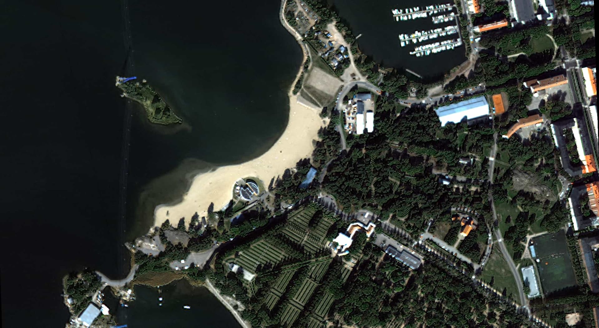
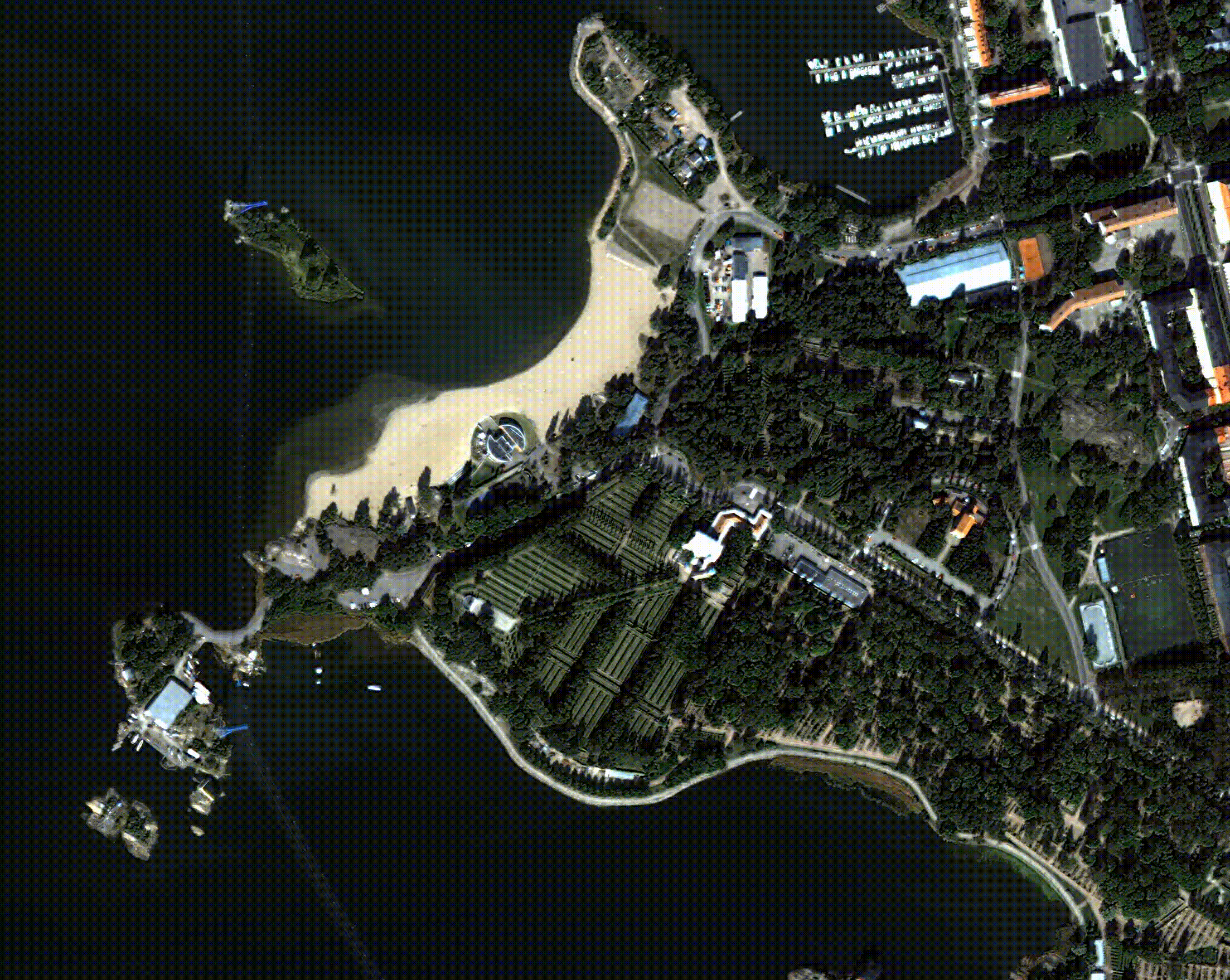 Hietalahti beach in Helsinki. 0.5 meters per pixel resolution makes it possible to distinguish even individual persons.
Pipeline from space
Like I stated earlier, Skywatch API works with a concept called Pipelines. Pipeline settings consist roughly of the following: area of interest, output type, date range, interval and resolution. So for example: “For Tampere area, I want a medium resolution true color image for every week of 2020”. The date range can include both past and future dates, so it’s possible to create an ongoing earth observation process. The whole process can be automatized with a webhook that gets called every time the pipeline status changes.
In addition to getting images from the archive, there is a feature that took me straight back to being 10 yo and watching the supervillain command the satellite weapon called Golden Eye in the similarly named James Bond movie. Just type the coordinates and wait for the orbit to align. This is actually something you can do via the Skywatch API. Well, apart from having a weapon or seeing the orbit align in real time. It doesn’t even cost millions, but as little as 300 USD. I didn’t yet figure out an exciting enough idea to try that, but might as well for a good cause.
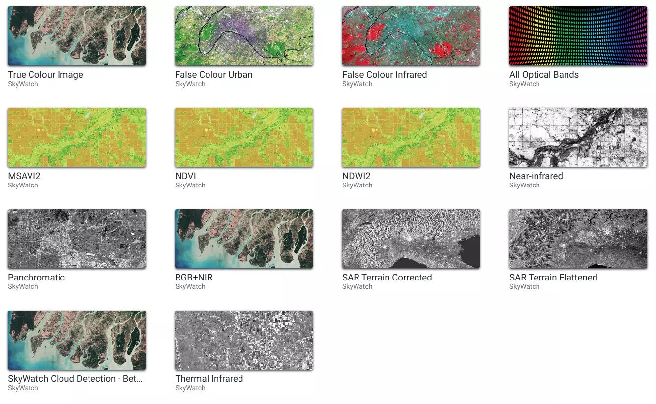 In addition to sticking with visible light, there are options for using other optical bands or processed images.
Data quality and availability
An important thing I learnt while playing with the pipelines was that high resolution satellite data is not an endless resource. I’ve seen the marketing materials of many companies stating something like “the whole globe twice a day”. Still at least here in latitudes over 60, it looks like the game is more about using the data you find rather than having exact date requirements for the images. Experts from Skywatch told that it’s because the high resolution satellites do not have continuous shooting mode, but they only take photos when tasked to do so. Like when the supervillains have tasked a capture for a certain region and date, also everyone else can access the data afterwards.
The above is true for high resolution images. It’s better to think the high resolution availability so that if you have a long period of time, there might be some high resolution data available. But definitely not for any date and location. After exploring the platform, I’d say that generally the high resolution data is not available unless you get lucky. For medium and low resolutions, the availability of data is generally much better.
There are also some other variables in the equation of availability. If you want to observe a certain area at a certain time, it may just be that the weather is cloudy. For that, there is a parameter for area of interest. The default value is 90%, so there might be a 10% area covered with clouds. Also what I noticed was that because the time interval for the photos is a minumum of one day, you cannot request a photo from a certain time of day. So it might be that some of your images are taken in the morning and some in the afternoon. So the direction and lenght of shadows and how light or dark the photos are may vary.
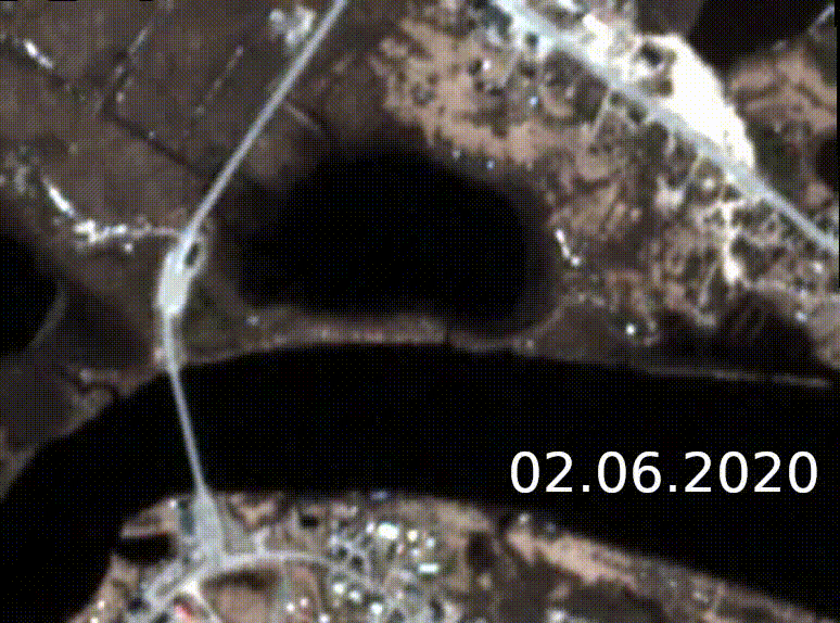 Flooding in northern Finland found on satellite images after running into this article. 3 meters per pixel
Differences in resolutions
The resolution names work as shortcuts on the UI of the platform, but in reality those are predefined resolution ranges. Low resolution is anything between 10 and 30 meters per pixel, medium is from 2 to 4.5 meters and high is down to 0.3 meters per pixel. When creating the pipelines using the API, one has to define the range of acceptable resolutions and the priority for choosing a single photo from multiple matching the criteria. You can prioritize either the resolution or the accurate date more.
So what exactly does low or high resolution mean? On the image below, you can see the same area with three different resolutions. On the low resolution image, big features like roads, fields and forests are easily seen. Using more than one image will also make it possible to detect changes in features, which might not be obvious to human eye when looking at a single frame. On the medium resolution image, more features are visible and it’s possible to detect for example individual trees on open areas and pathways going across the forest. Finally on the high resolution image, individual cars can be seen racing through the track and trees can be distinguished from each other even in the forest. The high resolution photo is with 0.8 meters per pixel resolution, but it’s possible to get even higher resolution images. Up to 0.3 meters per pixel resolutions are available and going under 0.5 meters resolution, even individual persons can be detected.
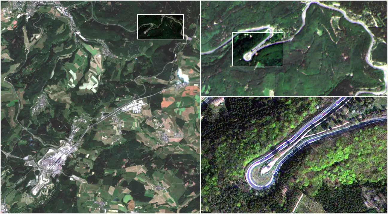 Iconic racetrack Nürburgring Nordschleife and the famous Carousel in 10, 3 and 0.8 meter resolutions.
A penny for your pixels
While launching cameras into space is still quite an expensive journey, buying the satellite data doesn't put any accidental dents in your credit card. On the Skywatch platform, the low resolution data is free! Admittedly, at least some of it is open data and is available also elsewhere, but not necessarily in such an easy format. The higher resolutions come with a price, but those are quite reasonable also. The medium resolution cost is 2,50 USD/km² and high resolution 10 USD/km² if found from the archive. If you need to order the satellite to get the high resolution photos, it costs 12 USD/km² but has a 25km² minimum area. These prices are for my current plan and there is another plan with even cheaper prices, but it comes with minumum billing of 1000 USD.
The total price of operating with satellite data comes from your required intervals and resolutions. For example if you need a weekly image of 10 km² area in medium resolution, the price will be close to 1500 USD a year. Going for a daily high resolution image for the same area will end up in 40 000 USD. Real prices will include only the images that meet your criteria, so if there are intervals that don't have data for you, you won't pay for it either.
Polish your monocles, we have images to watch
Having this huge new source of data might be intimidating. Going through the images manually would be a really laborious process. That’s why it’s really important that the platform supports fully automatic processing. Photo orders, pipelines, can be done automatically via the API and the photos can be received programmatically after they are available. This allows building autonomous processes that are observing our home planet constantly.
To this date, the computer vision systems have been developing so fast that detecting features or classifying images has become really feasible. Combining computer vision with the amount of data available will make the observing much more efficient than any human could do. Whether it’s a ship, car or a damaged forest area you’re looking for, if it’s possible to detect with human eye, a computer will most probably detect it as well.
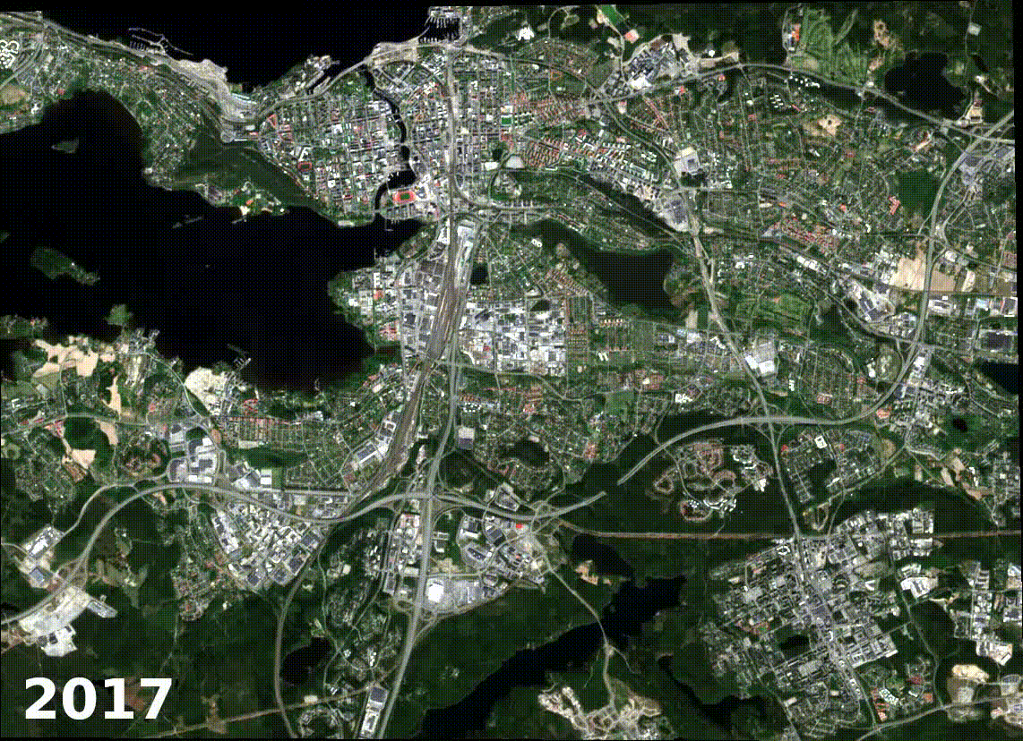 Development of Tampere area from 2017 to 2020 visualized with image difference. 10 m per pixel resolution.
Conclusion
Satellite data is something that can already be used in a wide variety of tasks. It’s really nicely available and affordable. Combined with computer vision and domain knowledge, there are endless possibilities to turn that data into new business opportunities. Frequent high resolution satellite observation might not be the most valid use case yet due to the price and availability of the data, but experimenting with satellite data in less demanding tasks is definitely worthwhile. The most important thing to note is that the technology and platforms are already here and ready to be built into fully automated continuous processes.
If you have any questions or would like to start experimenting with satellite data to find new opportunities, do contact us and let's go high above!
For more information about how we see drone and satellite data shaping the world, visit “New eyes in the skies”
 Mikko PohjaMaster Builder, Emerging Business


